 will england :: motorcycle rides : 6th principal merdian
 will england :: motorcycle rides : 6th principal merdian
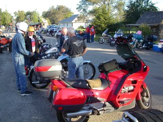
Jeff Schneider and I decided to go for a ride. This is not unusual. However, we actually were able to match family, work and his Nat'l Guard schedules and made the ride.
Tired of the usual 'wander around' rides, we wanted a destination. So, I picked from the Kansas Photo Tour website the "Sixth Principal Meridian" marker, on the KS - NE border. If we had time, we could swing by Cawker City and take a gander at the worlds largest ball of twine. Rides in the Midwest are what you make of them. We don't have the grand vistas or national monuments or famous eateries. So we look at posts and string.
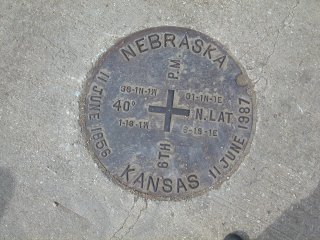
The marker for the sixth principal meridian is the point where surveyors originally assayed the land for most of Kansas, Nebraska, Wyoming and parts of Colorado. The entire section grid is based from this one point. Originally, the marker was a piece of red sandstone in a grassland field. Now, there is a road, a small obelisk marker commemorating the surveyors, and one half of the original sandstone marker, in a concrete and steel vault under the road. The other half has been taken to the Kansas State University museum.

|
1600x1200 Version |
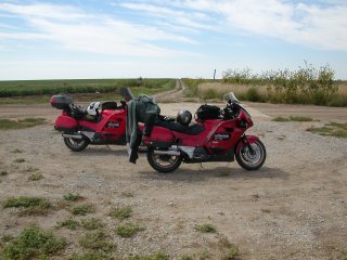
Took back roads up to Washington County, KS. Then it got funky. The maps showed this to be a real road. But, a few miles outside of whichever town the road went to gravel. At least it was fairly well groomed gravel. And sand. Did I mention the sand? About 10 miles of this. Then I spot a crossroad with the name of 'Meridian'. Now, that sounds about right. Too bad I was going so fast (at least 25) I couldn't stop on the sand in time. Slid past the intersection, flat tracking the ST along. Whuff!
Jeff stopped with no problem (elite riders and their ABS bikes) and waited for me to duck-walk that beast around and get back to the corner. Sure wish I had one of them 25" seat Harleys about now.

|
1600x1200 Version |
Fortunately, they did have the road graded, and sanded. Lots of sand. 4 or 6" deep in spots. Jeff and I were both goosing and dabbing along to keep our highway machines up. I kept a close eye on the odometer as we passed each house, so I would know how far I'd have to walk back after augering in. Not 'if' I crashed, but when. Seriously hairy riding. After 10 more miles of this crap, we finally see a patch of concrete in the middle of this 'road'. Looks like we made it up the sand trail without incident.
(A side note: many authors on rider training suggest getting your street bike off the road and onto some sand or loose gravel to enhance your control in low-traction surfaces. They are entirely correct. It's amazing how much 'out of control' you can be while still motoring along in gravel. In the 15 miles we traveled, I learned more about bike control than I had since I bought the ST1100.)

|
1600x1200 Version |
We posed for the photos standing on both sides of the border, then checked the GPS. Jeff saw a road in Nebraska only 5 miles away, which was a hell of a lot better option than the 10-plus miles of sand and dirt behind us.
The GPS was right - we found pavement, and headed back to US24. At Salina, we split up. Jeff headed back to Wichita, and I jumped on the interstate for a fast run back to KC. Arrived home just after 8:00 PM.
14 hours on the road, just over 600 miles. All for a post in a field.
Humbly Submitted,
Will England
September 7, 2003
|
|
|
yeah, I really get too much into these post and string rides
6th Principal Meridian (web.archive.org version)
Discussion of the township and range system that brought this surveying into existence
History of the township and range system, and surveying
[
Now
-- Main
-- Humor
-- Art
-- Food
]
[
seti@home
-- Shooting
-- Motorcycle
-- Blog
]
Disclaimer: Anything I have to say is mine, dammnit! My employers, clients nor anyone else can take credit (or be blamed) for it.
Author: Will England (will@mylanders.com) Complaints? /dev/null
This page is a Y to K complaint.
Created September 7, 2003 :: Updated Thursday, September 06 2018 @ 01:51am